Organization — www.uplandrivers.com
|
Location
Click Icon to Show on Map
|
City & Country |
|---|---|
|
,
|
()
|
| Countries: | -- | |
|---|---|---|
| Basins: | Indian Ocean (160) (Berg, Breede, Olifants, Sondag, South Africa South and West Coasts) | |
|
Organization SDGs:
Includes Sustainable Development Goals from the organization and its locations.
|
Sustainable Agriculture (SDG 2.4)
Water Quality (SDG 6.3) Protect and Restore Ecosystems (SDG 6.6) |
|
|
Organization Tags:
Includes tags from the organization and its
locations.
|
Stormwater Management and Flood Control
Drought Management Conservation Agriculture/Agronomy Dairy and Livestock Pesticide and Fertilizer Management Soil Erosion and Health Nature-Based Solutions |
|
| Services Offered: |
Other
Project management Technical assistance |
|
| Org. Type: | NGO / Civil Society | |
| Org. Size: | Very Small (1-9 Employees) | |
| Language: | English | |
| Org. Website: | www.uplandrivers.com | |
| Org. Source: | User | |
| Profile Completion: | 96% | |
| Coalition: | No | |
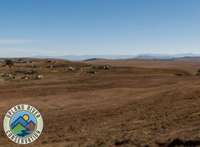
The conservation and restoration of river catchments in the highlands of the drakensberg mountain range in South Africa, outside of formal conservation parks, with a view to increasing water quality and quantity for downstream users.

Andrew Fowler
Founder
None found.
Impendle Vlei Initiative (Project)
The Impendle vlei lies near the village of kwaNovuka at the very headwaters of the Poort Stream, a significant tributary of the uMngeni River. This area falls within our Super Catchment Project area, and is also a habitat and potential … Learn More
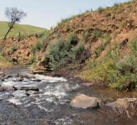
Streamside Restoration (Project)
Once initial clearing of wattle trees has been done, restoration of the natural grassland is required to prevent erosion, and to generate a grazing value for the recovered land. In areas that are very steep, or where significant erosion measures … Learn More
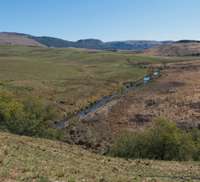
The Upper uMngeni Super Catchment (Project)
This is our flagship project. The idea is to focus on a well defined catchment, that being the upper uMngeni above the Dargle falls, and lend significant support to landowners in that approx 16,000 ha zone. Support includes: Alien invasive … Learn More
Upper Umtshezi Project (Project)
The Bushmans River (known locally as the Umtshezi), flows down from the Giants Castle resort in the Moloti Drakensberg Park, into a community that needs our help. There is a catchment that is degraded due to an absence of solid … Learn More
 Loading Suggested Resources
Loading Lessons
Loading Suggested Resources
Loading Lessons