Africa
|
Location
Click Icon to Show on Map
|
City & Country |
|---|---|
|
,
|
()
|
| Total Organizations: | 3 | |
|---|---|---|
| Total Projects: | 1 | |
| Priority SDGs: |
Sustainable Agriculture (SDG 2.4)
Increase Access to Water, Sanitation, Hygiene (SDG 6.1 & 6.2) Water Quality (SDG 6.3) Water Use Efficiency (SDG 6.4) Integrated Water Resource Management (SDG 6.5) Protect and Restore Ecosystems (SDG 6.6) International Cooperation and Capacity Building (SDG 6.a) Stakeholder Participation (SDG 6.b) Water-Related Disaster Management (SDG 11.5) Sustainable Production (SDG 12.4) Climate Resilience and Adaptation (SDG 13.1) |
|
| Priority Regions: | Gambia | |
| Priority Industries: |
Apparel
Biotech, health care & pharma Food, beverage & agriculture Power generation Retail Services |
|
| Organization Types: |
67%
NGO / Civil Society
33%
International Organization
|
|
| Profile Completion: | 73% | |
Total annual estimated cost to address all water-related challenges: $173,549,636.00
Share of total annual estimated cost to address each individual challenge (2015 $USD):
For more about this data, see information on WRI’s Achieving Abundance dataset here.
As reported by organizations on the Hub.
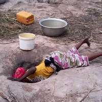
1.1.1.WATER RESOURCES The River Gambia originates in Fouta Djallon in the mountain region of western Guinea and flows through Senegal before entering the Gambia. Within the country, the River Gambia flows from east to west for about 400km. It is a major waterway and tourist attraction. Its floodplains, riverbanks and wetlands are important habitats for wildlife and play an important role in local livelihood strategies. Its flow is highly seasonal. The maximum flow occurs at the end of the rainy season in late September or October with a flow of about 1,500m3/s; the minimum dry season flow is less than 4.5m3/s. Both measurements are taken at Gouloumbo in Senegal. Because of the flat topography there is a pronounced marine influence and the river’s seasonality and salinity have important repercussions on land use. The country’s total actual renewable water resources are estimated at 8km3/year, of which about 3km3 are internally produced and the remaining 5km3 represent the inflow of the River Gambia from Senegal. It is estimated that internally produced groundwater amounts to about 0.5km3/year, all of which is drained by the River Gambia and becomes the base flow of the river. Groundwater is available in all parts of the Gambia. The country is located in one of Africa’s major sedimentary basins and is often referred to as the Mauritania/Senegal basin. It is characterized by two main aquifer systems with water table depths varying from 10m to 450m. Along the river, the width of the valley varies from 20 to 40km and three major sections may be distinguished: -the upper valley (UV), where floods occur occasionally and water is always fresh; -the central valley (CV), where tidal influence exists but water is also fresh. In the lower CV water is fresh only during the rainy season while in the dry season, when the salt tongue moves as far as 250km upstream, it becomes brackish. Thus, in the dry season, about 220km of freshwater are left in the central and upper river divisions; and -the lower valley (LV), where water is perennially saline because of permanent tidal influence. Water resources comprise ground and surface water. The groundwater exists in two aquifer systems: (1) a shallow sand aquifer; and (2) a deep sandstone aquifer. The shallow sand aquifer occurs at depths of 10-50m below ground level (mbgl) and the deep sandstone aquifer is at depths greater than 250 mbgl. The current exploitation of both aquifers is minimal with only a few boreholes used for irrigated agriculture. Surface water on the other hand, is principally utilized in the central river region (CRR) where the river is perennially fresh and used for rice irrigation. The irrigated area has stagnated at around 25km2 partly because of the limitation of steep river banks (requiring pump uplift) and salinization (70km at the end of the rainy season and 250km at the end of the dry season) on the westward front and partly because of lack of sustainable irrigation systems [WAEA, 2008]. Freshwater resources in the Gambia occur in a variety of environments, but a reductionist, yet physically-based simplification, leads to two broad classes of water resources: 1) surface water; and 2) groundwater [Njie, 2009]. For surface water resources, the country counts on a few ephemeral coastal streams and two transboundary rivers. One of these, the River Gambia, is shared with the republics of Guinea, Guinea-Bissau and Senegal; the second, the Allahein River (San Pedro) is a low volume river system delineating the south-western border between the Gambia and Senegal in its lower course. Total renewable surface water resources of the country are estimated to be 6.5km³/yr, of which 5.5km³/yr (85 per cent) come from the upper Gambia River Basin spread over Senegal and Guinea. Within the Gambian territory, Gambian river flows are influenced by oceanic tides, affected by evaporation and rainfall, and augmented by groundwater discharge into the river and its tributaries. In recent decades, monthly flow at Gouloumbo ranges from 800m³/s to less than 1m³/s. One effect of this high seasonality is a 100 to 160km excursion of the salt and fresh water interface (i.e. salt front) within the estuary creating perennially saline, seasonal and perennially freshwater zones. Flows in the Allahein River are not accurately determined but are insignificant; judging from flow duration and peak floods falling well short of 10m³/s. Specific discharge in other coastal catchments is roughly 0.5 litres/s/² [Njie, 2009]. Regarding groundwater resources, the Gambia sits on top of one of the continent’s major sedimentary basins referred to as the Mauritania-Senegal-Gambia-Guinea-Guinea-Bissau (MSGGGB) Basin. This is characterised by two main aquifer systems, a shallow sandstone aquifer (SSA) and deep sandstone aquifer (DSA). In places, the SSA occurs as distinct phreatic and semiconfined aquifer (SCA) units. The phreatic aquifer is found at depths ranging from 4 to 30m below ground level (mbgl), whilst the SCA occurs between 30 and 50mbgl. A Department of Water Resources Study dating from 1983 which estimates SSA reserves at 0.1km3 is probably on the low side. The deep sandstone aquifer (DSA) which occurs at depths below 250m is estimated to hold reserves in the order of 80km3 (Njie, 2009). One to two metres' groundwater level/head fluctuations, depending on annual recharge (1.5 to 3.0km3/yr), is observed in the SCA and phreatic aquifer (Source: Department of Water Resources). All or most phreatic and SCA recharge occurs through direct infiltration. Vertical leakage and lateral inflow from Senegal account for roughly 10 per cent of the SCA recharge. Lateral inflow is the only known mechanism for DSA recharge. Where geological and hydrodynamic conditions allow for interaction between phreatic aquifer and surface water, groundwater contribution to surface water flow can be relatively substantial between January and May (Njie, M., 2009). Threats to water resources Country Overview - Gambia Water resources are subject to a several natural and human pressures including: 1) climate change and variability, 2) abstractions, 3) wastewater disposal, and 4) urbanisation. In the absence of adequate management responses, some of these pressures could even pose a threat to long-term water security (Njie, M., 2009). Major threats to surface and groundwater resources, defined by their magnitude, persistence, and social impacts are identified as: i) depletion of water stock, and ii) pollution of water resources. Single and multiple risks posed by these threats can be summarised as creating scarcity through reduced water resources availability and suitability for multiple purposes, leading to increased development, treatment and delivery costs of water (Njie, M., 2009). Depletion of surface water resources is not currently as significant a problem compared to quality degradation. However, water abstractions for rice irrigation, and, increasingly, plantation crops in the Upper River Region (URR) could alter the dynamics of saline intrusion in the River Gambia (Njie, M., 2009). Risks of groundwater depletion owe a lot to increasing demand associated with population growth, but are equally amplified by urbanisation, the latter having the double effect of concentrating demand and reducing groundwater recharge (Njie, M., 2009). In urban areas within the Kombos, where threats to groundwater quality are greatest, potential sources of pollution include: 1) quarries/surface mines, 2) leaky sanitary soakaways at public standpipes, 3) on-site sanitation systems, 4) solid waste tips/landfills, 5) unlined drainage ditches, and 6) underground storage tanks (Njie, M., 2009). Although agricultural runoff/drainage may constitute a source of pollution of surface water, uncontrolled flow/stormwater represents the main threat to quality degradation. But since stormwater quality is not monitored (even selectively), data on traditional methods of rice irrigation provides some useful insight. Nutrient losses reported in sparse literature suggest that approximately 120t/yr of chemicals, principally NPK, urea, malathion and finitrothion, are exported from cropland areas to the River Gambia. Obviously, export rates are likely to be higher under poor water control conditions, and intensified by heavy downpours (Njie, M., 2009). Total water withdrawal was 31.8 million m3 in 2000. The largest water user was agriculture with 21.3 million m3/year (67 per cent), followed by the municipal sector with 6.9 million m3/year (22 per cent) and industry with 3.6 million m3/year (11 per cent). Surface water is rarely used as a source of potable water in the Gambia, because of the continuously saline conditions which exist in the lower reaches of the River Gambia and its tributaries, where the population centres and tourism facilities are located. The potable water demand for urban areas, tourism, industry, irrigation and livestock watering is supplied by groundwater sources. In the Gambia, the resources that are made available for irrigation, especially labour, are influenced by a particularly complex network of rights and obligations in rural society. Women in rural communities traditionally play an important role in the allocation of family labour to food production tasks. The introduction of irrigation, or the technical formalization of existing water-use systems, involves in most communities a change in the traditional farming system. Women are major participants in irrigation at field level, however there is only scant evidence that they participate significantly in water management or policy decisions at system, regional or national levels. National water use inventories have been recommended and planned but never implemented. Accordingly, relevant information is obtained from socioeconomic variables in conjunction with unit consumption rates for different uses considered (Njie, M., 2009). Notwithstanding, the possibility of underestimating per capita demand for households is not negligible. Estimated demand and trends clearly show that irrigation and domestic water requirements account for more than 90 per cent of total demand nationwide, with irrigation alone accounting for more than 70 per cent. Demand is growing fastest in the livestock and domestic sectors. In the Kombo Peninsula, comprising coastal catchments and south bank areas close to the mouth of the Gambia estuary, where groundwater is the only source of freshwater, domestic water demand accounts for more than 50 per cent of the total and is expected to reach 80 per cent by 2050 (Njie, M., 2009). Pumping irrigation water from the River Gambia has a potentially negative impact on the salt front in the river and thus on the environment overall. It has been estimated that if 1m3/s is pumped from the upper river during the dry season, the salt front can move up to 4km upstream. Deforestation is a problem due to the high and ever-increasing demand for fuel wood. In all but a few isolated pockets, groundwater quality falls within the recommended World Health Organisation (WHO) guidelines. Nonetheless, groundwater tends to be slightly acidic, with most pH values lying between 5.0 and 6.5. The presence of 2 to 5mg/litre of total dissolved solids including fluorides make the DSA water unsuitable for drinking without further treatment (Njie, 2009). In coastal catchments and downstream of Tendaba in the Gambia River Basin where more than half the population live and industries are concentrated, surface water is not considered a source of potable water. This state of affairs owes a lot to continuously saline conditions which exist in the lower reaches of the River Gambia and its tributaries, and the patchy nature of flows and poor water quality in coastal streams. By way of comparison, groundwater is widely available and of relatively good quality. Therefore, water use follows very simple lines: 1) seasonal or perennial freshwater resources in the river Gambia are exclusively used for irrigation; and 2) groundwater is used for all other purposes, in particular domestic water supply. It should be noted that river water usage is restricted by transportation costs over long distances from the river and the need for treatment to make the water fit for human consumption. Wide availability of groundwater and easy/convenient access makes it the preferred source of water (Njie, 2009)
Coming Soon

African Agency for Integrated Development (AAID) (Organization)
To Strengthen the marginalised and needy among the community to come up with sustainable, low cost and gender responsive solutions to their problems Learn More

Amesbury for Africa (Organization)
Amesbury for Africa is a unique partnership between a rural town in Massachusetts and a Kenyan farming village near Lake Victoria in East Africa. The overall purpose of our partnership is to exchange visitors between our two communities. Through these … Learn More
The Rural Child-RC (Organization)
To create a platform and an institution where rural children, youth and women can be given the opportunity to explore their talents in every field, by empowering and exposing them to issues that can inspire and motive them to positively … Learn More
 Loading Suggested Resources
Loading Lessons
Loading Suggested Resources
Loading Lessons