Project — www.firstclimate.com/en/our-carbon-offset-projects/peru-sust...
|
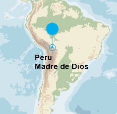
Location
Click Icon to Show on Map
|
City & Country |
|---|---|
|
,
|
()
|
| Countries: | Peru |
|---|---|
| Basins: | -- |
|
Project SDGs:
Includes Sustainable Development Goals from the project and its locations.
|
Protect and Restore Ecosystems (SDG 6.6)
Climate Resilience and Adaptation (SDG 13.1) |
|
Project Tags:
Includes tags from the project and its
locations.
|
Nature-Based Solutions |
| Progress to Date: | Total emissions reduction: 660.000t CO2 p.a. Total emission reductions |
| Services Needed: | Monitoring & evaluation |
| Desired Partner: | Other |
| Language: | English |
| Start & End Dates: | Jan. 01, 2009 » Ongoing |
| Project Website: | www.firstclimate.com/en/our-carbon-offset-projects/peru-sust... |
| Contextual Condition(s): | PHYSICAL: Water scarcity or drought, PHYSICAL: Ecosystem vulnerability or degradation, REGULATORY: Inadequate river basin management |
| Additional Benefits: | Basin stakeholder mapping |
| Beneficiaries: | Ecosystems, Environmental users (e.g., fishers, recreational users) |
| Planning & Implementation Time: | More than 3 years |
| Primary Funding Source: | pool |
| Project Challenges: | Other |
| Project Source: | User |
| Profile Completion: | 87% |
The Amazon basin stretches over 8 million square kilometers. Inaccessibility provides effective protection for invaluable habitats for animals and plants. Madre de Dios province in the East of Peru is a prime example of this remoteness. Scientists estimate that 10% of the animal species in the area are still unknown.
Since August 2011, the Interoceanic Highway cuts through the region. It is more than 2,600 kilometres long and connects the Brazilian part of the Amazon to the …

Sascha Lafeld
CEO
| Basin and/or Contextual Conditions: | PHYSICAL: Water scarcity or drought, PHYSICAL: Ecosystem vulnerability or degradation, REGULATORY: Inadequate river basin management |
|---|---|
| Project Benefits: | Basin stakeholder mapping |
| Indirect or Direct Beneficiaries: | Ecosystems, Environmental users (e.g., fishers, recreational users) |
| Months & Implementing: | More than 3 years |
| Primary Funding Source: | Pool funding (i.e., joint funding of several partners) |
| Challenges: | Other |
First Climate (Organization)
www.firstclimate-climateneutral.com
First Climate is a globally leading provider of water project development and carbon offset services. We help our corporate clients across Europe, Asia-Pacific and the US to get engaged in water stewardship activities and manage and compensate their carbon emissions. … Learn More
 Loading Lessons